
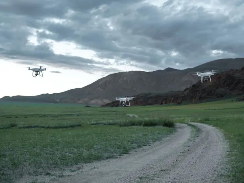
DJI has introduced the Matrice 5T, a new enterprise-level drone engineered specifically for search and rescue missions, emergency response operations, and demanding industrial inspections. Built to operate in environments with extremely limited visibility, the aircraft integrates high-resolution thermal imaging and enhanced night vision capabilities to help operators examine difficult locations. The drone delivers up to 59 minutes of flight time, features improved obstacle avoidance, and provides an extended communication range for missions across challenging terrain.
At the core of the Matrice 5T imaging system is a thermal camera with a native 1280 by 1024 resolution, which yields four times as many pixels as conventional 640 by 512 sensors. Operators can also utilize an ultra-high-resolution infrared mode that increases output to 2560 by 2048 to examine heat patterns with finer detail. For low-light conditions, the wide-angle camera uses a 1/0.98-inch sensor with an f/1.8 aperture and artificial intelligence enhancements. DJI states that the system captures full-color images under illumination measuring just 0.01 lux, a remarkably dark operating environment.
Key takeaways
- The Matrice 5T thermal camera features native 1280 by 1024 resolution, offering four times the pixels of standard sensors.
- An integrated LiDAR system can detect thin obstacles like electrical cables from up to 32 meters away at night.
- The drone supports up to 59 minutes of flight time and an IP55 environmental protection rating.
- The O4 Enterprise transmission system allows connectivity ranges reaching up to 40 kilometers.
The aircraft also features a 50 megapixel medium telephoto camera equipped with 3x optical zoom for infrastructure examination. A second telephoto lens provides 11x optical zoom, 176x hybrid zoom, and monochrome night vision, enabling operators to identify license plates from distances up to 400 meters away. Obstacle detection is handled through a combination of LiDAR, millimeter-wave radar, and omnidirectional visual sensors. The LiDAR system can identify thin power lines and electrical cables from distances reaching 32 meters during nighttime operations, while radar assists with navigation when fog, rainfall, or airborne dust interfere with standard visual sensors.
Communication and coordination have also been improved through the O4 Enterprise system, which supports transmission distances of up to 40 kilometers. The platform utilizes automatic frequency switching to maintain stable connections around urban interference, alongside cellular connectivity and relay configurations to bypass physical obstructions. The drone's onboard artificial intelligence can simultaneously identify more than 20 object categories by processing thermal and conventional camera feeds. Connected operators using DJI FlightHub 2 can search for objects via written descriptions or reference images, then establish automated patrol routes.
For surveying and industrial assessments, DJI Terra supports centimeter-level measurements without ground control points under specified conditions. The software generates thermal maps, measures temperatures, and flags abnormal heat patterns during inspections of solar installations and electrical infrastructure. Furthermore, the remote controller can process 200 photographs within eight minutes to generate point clouds or 2.5D models for field assessments. Built to withstand harsh weather, the Matrice 5T carries an IP55 rating and functions in temperatures ranging from minus 20 degrees Celsius to 50 degrees Celsius. The aircraft is available for purchase now through authorized DJI Enterprise dealers.






Comments